Selected solution
Selected substation site
In fall 2020, Hydro‑Québec conducted inventories of the biophysical and human environments, as well as geotechnical studies to characterize the soil.
Following the resumption of draft-design studies, the substation site was selected based on environmental, technical and social criteria, including:
- Limitation of the length of the supply line
- Easy access by Chemin de la Savane
- Sufficiently large area of flat and stable ground
- Proximity to the load centers
- Avoidance of wetlands, rivers, streams and tapped sugar bushes
- Distance from residential areas
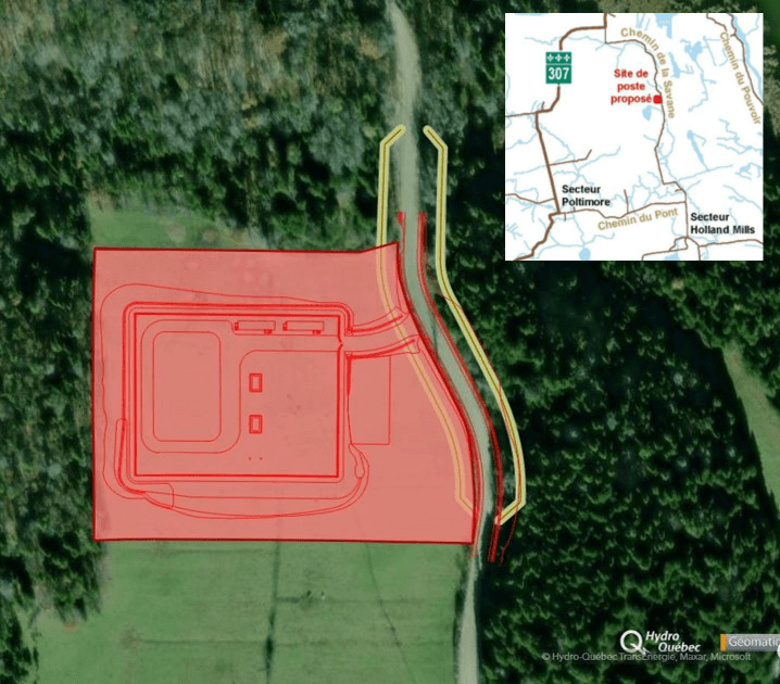
The 120/25-kV substation will be located in Val‑des‑Monts on Chemin de la Savane, between Chemin du Pont and Chemin du Marais.
This location is near the load centers, which will allow us to build shorter distribution lines and a shorter 120-kV supply line and improve the quality of electricity service.
The substation will be built in a pasture far from residential areas and farm buildings.
Technical characteristics of the proposed substation
The fenced area of the new Val‑des‑Monts substation will extend about 0.85 hectares on a 2.63‑hectare lot. The substation will include two 120/25‑kV transformers, six 25‑kV feeder bays and the space for an additional feeder bay to meet future needs. A multifonctional building is also planned.
Substation development map [PDF 137 KB - in French only]
Selected line route
Hydro‑Québec initially identified two supply line routes, based on the following criteria:
- Shortest and most direct route
- No steep slopes
- Avoidance of large bodies of water
- Avoidance of the white-tailed deer yard
- Optimal integration of the line into the landscape
- Distance from populated areas and farm buildings
- Avoidance of territory fragmentation
- Avoidance of wetlands and tapped sugar bushes as much as possible
At the end of the public participation process, Hydro‑Québec chose one of the two proposed routes and optimized it.
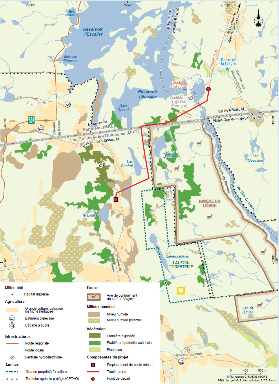
The selected route is the shortest and least visible to the community. With a length of 4.7 km, it crosses the Rivière du Lièvre downstream of High Falls generating station in Val‑des‑Bois and bypasses the white-tailed deer yard. It avoids tapped sugar bushes, but crosses a few untapped ones. Although the route passes over a pasture and wetlands near the proposed substation site, no towers will be erected in these types of environments.
The route is far from residences, but runs about 120 m from a cottage between Lac Central and Lac Brochet, east of the right-of-way. It then crosses Chemin de la Savane to finally reach the substation’s north side.
Selected line route map [PDF 354 KB – in French only]
Towers and right-of-way
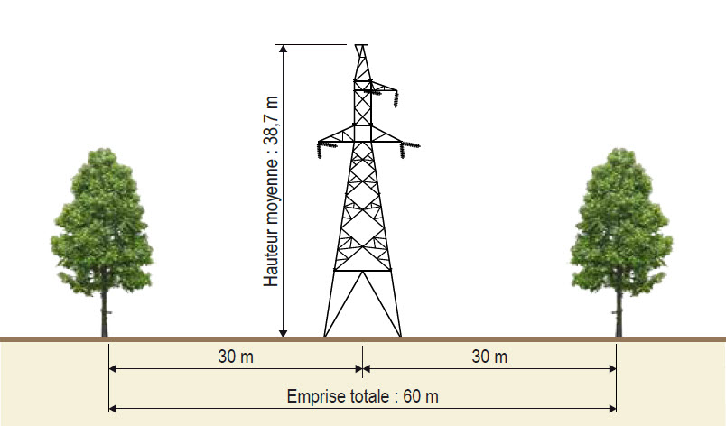
The substation supply line will be supported by guyed steel lattice towers. Four-legged steel lattice towers will be used for angle and dead-end towers.
The number, height and location of towers will be determined during the detailed engineering stage according to the terrain and the distance between towers. However, we already know that the average height of towers will be 45 m and the new right-of-way will be about 60 m wide.
We will develop a few helicopter landing areas to be used for maintenance and emergency response operations.
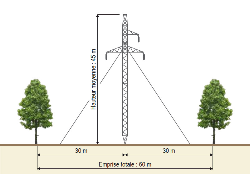
* For technical reasons, the width of the right-of-way could reach 71 m in the Chemin de la Savane sector.
Goal of main improvements
- Minimize the substation’s footprint in agricultural areas by building a shorter, more direct access road to the substation.
- Maximize use of existing roads to access line construction sites.
- Adapt clearing methods for the new line in order to preserve woodlands as much as possible.
- Ensure good visual integration of infrastructures by adding a vegetation screen where necessary.
Hydro‑Québec will continue to collaborate with the various stakeholder groups at the detailed engineering stage and during project implementation.