Important reminder
In the event of a flood, contact your municipality. They will advise the Ministère de la Sécurité publique du Québec, which coordinates all flood-related activities.
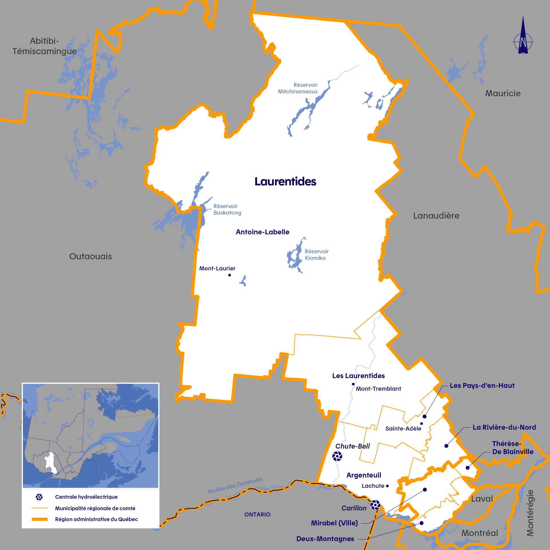
Laurentides
Reducing spring flooding in the Rivière des Outaouais watershed: A team effort between Hydro-Québec and its partners
Hydro-Québec has two generating stations in the Laurentides region: Carillon generating station on the Rivière des Outaouais (Ottawa River), and Chute-Bell on the Rivière Rouge, a tributary of the Outaouais. Both facilities are run-of-river generating stations, which means that they cannot hold back or store water in a reservoir.
The Rouge and Outaouais rivers are part of the Outaouais watershed, which is home to several facilities operated by various agencies. These agencies work in close collaboration to ensure the sound management of the flows and water levels in the watershed’s rivers. Hydro-Québec is an active member of this partnership, which is managed by the Ottawa River Regulation Planning Board (ORRPB).
Visit the ORRPB website to track the hydraulic conditions of the Rivière des Outaouais. You will also find historical water level and streamflow summaries
 , with some dating back to 1950.
A tool that identifies flows and water levels
We are installing measuring instruments on rivers and reservoirs where we operate dams and generating stations. They provide flow, water level and meteorological data. This data is available to you through a simple tool, which can provide information about flows on rivers and water levels in reservoirs.
Learn more about the Tool
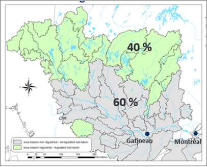
Rivière des Outaouais: Our reservoirs reduce the impact of flooding across 40% of the watershed
In spring, Hydro-Québec and its partners fill their reservoirs to near capacity and store the water to limit the impact of spring flooding on communities. However, the reservoirs located in the northern part of the Outaouais watershed have access to only 40% of the water inflows. The remaining 60% come from the southern part of the watershed, downstream of the facilities that can hold back water. As a result, the water flowing south of the reservoirs cannot be managed or held back. Although the collaborative efforts of Hydro-Québec and its partners can reduce flows during spring runoff periods, they cannot prevent floods in certain areas when the inflows are too high, since only four out of ten drops of water flow through control structures.
Did you know?
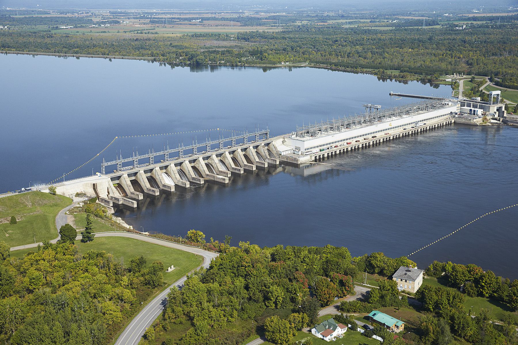
Carillon generating station, which is located at the foot of the Rivière des Outaouais watershed, is a run-of-river generating station.
It does not have a reservoir and therefore cannot store spring flood water. During flood periods, the spillway discharges the excess water.
If the spillway gates were closed at the peak of the high water levels due to spring flooding, the water would spill over the facility within a few hours!
Role of the Ottawa River Regulation Planning Board
Several large rivers flow into the Rivière des Outaouais, which drains a watershed of 146,000 km2 and covers a distance of 1,120 km, from Abitibi-Témiscamingue to Montréal. These inflows make the Outaouais a significant tributary of the Rivière Saint-Laurent (St. Lawrence River) near Montréal. Hydro-Québec is not the only operator of reservoirs and generating stations in the Outaouais watershed. Managing the water levels and flows in the Outaouais is a collaborative effort between partners. Every drop of water in the river is monitored by the Ottawa River Regulation Planning Board (ORRPB).
The ORRPB is made up of all the agencies that participate in managing the Outaouais watershed: the Ministère de l’Environnement, de la Lutte contre les changements climatiques, de la Faune et des Parcs du Québec, the Ministry of Natural Resources and Forestry of Ontario, Environment and Climate Change Canada, Public Services and Procurement Canada, the Canadian Coast Guard, Ontario Power Generation and Hydro‑Québec.
Visit the ORRPB website to track the hydraulic conditions of the Ottawa River.
Watch our expert explain how Hydro-Québec manages spring flooding along this river.
Chute-Bell development: We have improved the discharge capacity of the structures
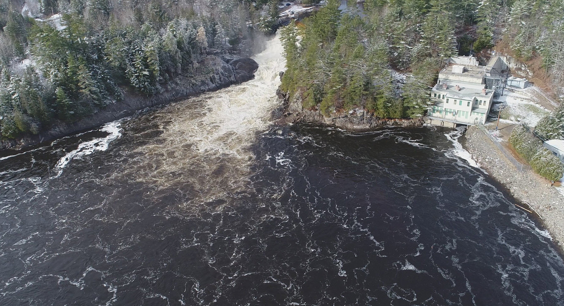
The Chute-Bell development includes a run-of-river generating station, which is no longer used to produce electricity, and a weir. The facility cannot retain water the way that facilities equipped with a reservoir can.
During the winter of 2019–2020, Hydro-Québec carried out major work to increase the discharge capacity of the Chute-Bell structures. In the event of exceptionally high flows in the Rivière Rouge, the expanded weir, along with the original waterways of the generating station, can now discharge more water, reducing the impact of the flood.
For more information on the Rivière Outaouais watershed, visit the Ministère de l’Environnement, de la Lutte contre les changements climatiques, de la Faune et des Parcs (web page in French only).
Questions on how Hydro‑Québec facilities are managed? Write to us at Affairesregionales@hydroquebec.com.
