Important reminder
In the event of a flood, contact your municipality. They will advise the Ministère de la Sécurité publique du Québec, which coordinates all flood-related activities.
Bas-Saint-Laurent
Our reservoirs in Bas-Saint-Laurent limit the impacts of spring runoff
A tool that identifies flows and water levels
We are installing measuring instruments on rivers and reservoirs where we operate dams and generating stations. They provide flow, water level and meteorological data. This data is available to you through a simple tool, which can provide information about flows on rivers and water levels in reservoirs.
Learn more about the Tool
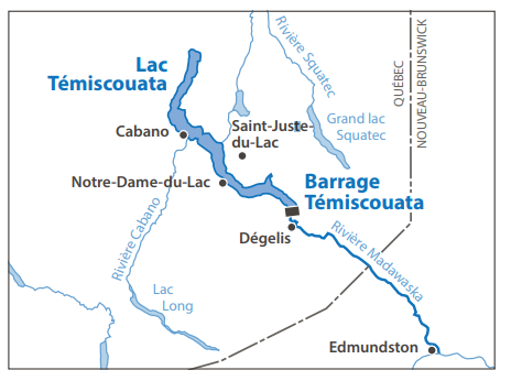
Lac Témiscouata acts like a reservoir, holding back spring floodwaters
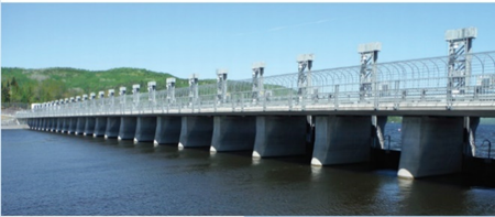
Thanks to the presence of the dam, Lac Témiscouata is managed like a reservoir: it is emptied gradually in the winter so that it can help limit the impact of the spring runoff. The dam is composed of a 25-gate spillway and a fish pass, which allows species to travel freely between upstream and downstream. Outside of spring runoff season, the level of the lake is controlled by three gates.

Forecasting precipitation (snow and rain) plays an essential role in the management of Témiscouata dam. Before the spring thaw, Hydro-Québec drains the lake to a minimum level of 147 m, determined based on the water intake at Témiscouata-sur-le-Lac. This limits the impact of the spring runoff. During the spring runoff period, we open the spillway gates according to a specific sequence. When all 25 gates are open, the lake level depends on natural inflows, which are inherently unpredictable.

During high flood periods, the level of Rivière Madawaska, at the foot of the dam, rises to meet the level of Lac Témiscouata. When this happens, the dam no longer restrains the flow, meaning that the maximum amount of water evacuated depends entirely on the Madawaska’s flow capacity. However, in some stretches of this river, bottlenecks are created, which have a funnel effect that considerably slows down the flow. These narrower stretches limit the quantity of water that can flow through Témiscouata dam.
Mitis watershed: Although the magnitude of spring runoff depends on the weather, it is reduced by our reservoirs
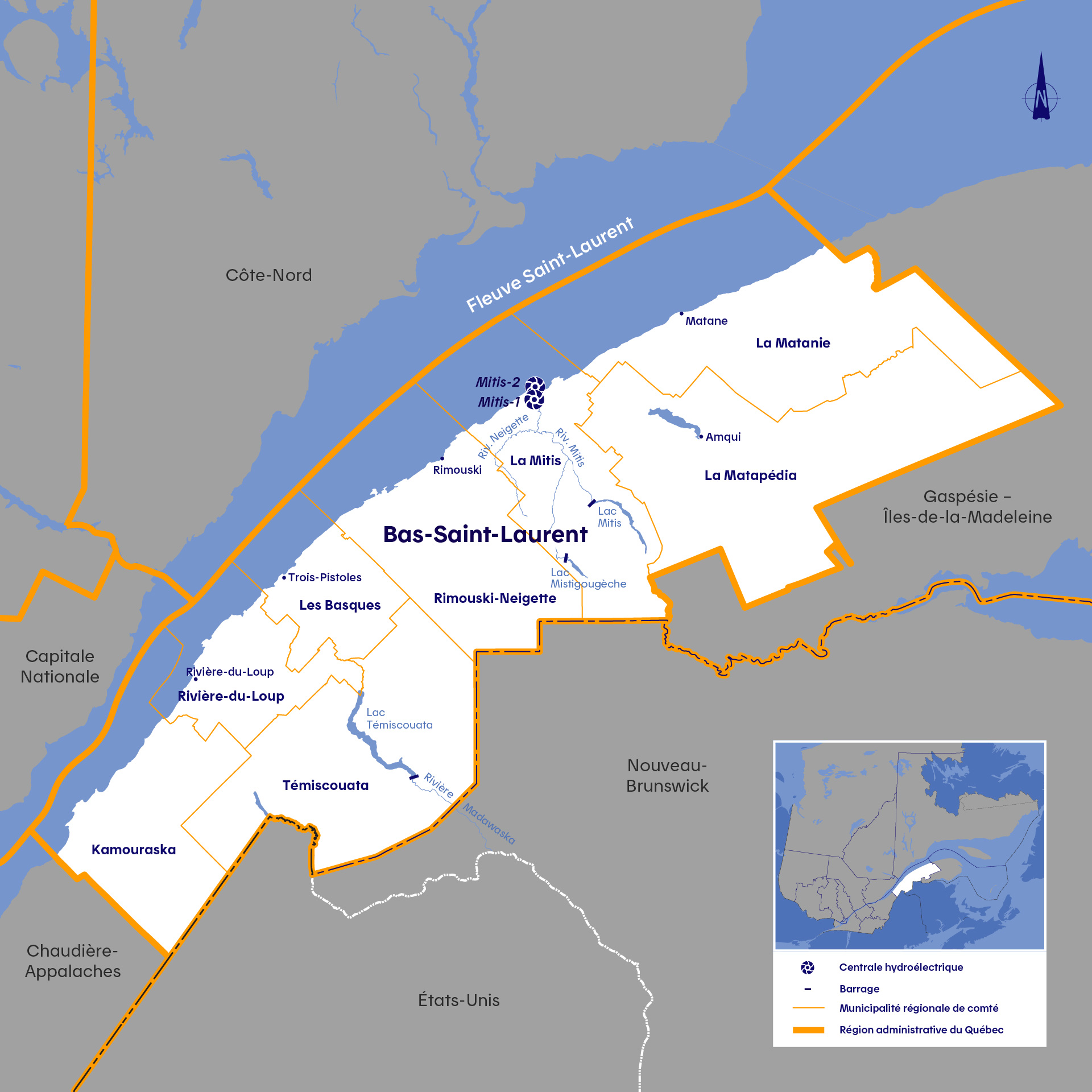
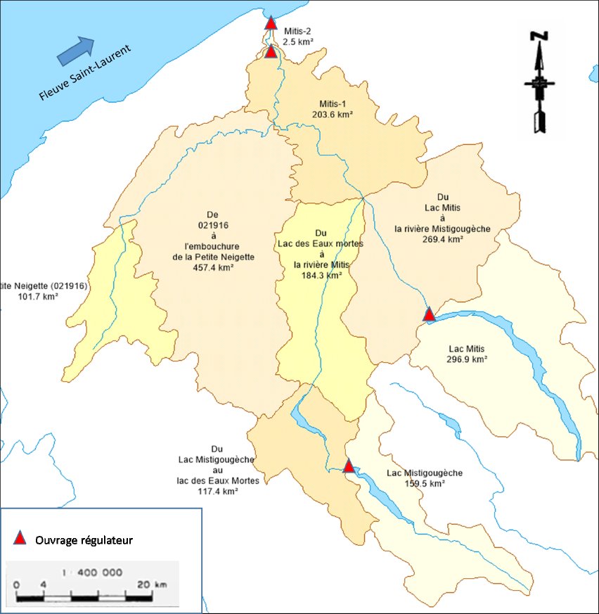
The Rivière Mitis watershed includes two headwater reservoirs (Mitis and Mistigougèche lakes) and two run-of-river generating stations (Mitis-1 and Mitis-2). In addition to the flow from the headwater reservoirs, Mitis-1 and Mitis-2 facilities receive significant inflows from Rivière Neigette and from the watersheds of Mitis and Mistigougèche rivers, over which Hydro-Québec has no influence.
Every year, Hydro-Québec gradually drains its reservoirs in the winter, to make room for as much water as possible during the spring flooding. However, Mistigougèche and Mitis lakes cannot absorb all the spring runoff. The water that flows into the Mitis downstream of these structures is only about 25% of the volume of water coming from the many tributaries of this river.
When the spring runoff starts, Hydro-Québec closes the gates of its facilities to minimize the volume of water released into the Mitis, which in turn limits the impact of the runoff. The flow of water from the headwater lakes into the river is only increased again after the runoff has slowed and flood risks for neighboring communities have declined.
The intensity of the spring runoff depends entirely on weather conditions. For example, there is less runoff when the snowpack absorbs less heat and rain is scarce. On the other hand, warm, rainy springs accelerate snowmelt and increase flood-related risks. As a general rule, the stock of snow is not the only indicator of the magnitude of the coming flood. The intensity and duration of spring rains have a huge impact on flooding.
Did you know?
Hydro-Québec analyzes the potential of idle generating stations
Hydro-Québec is looking at various ways of meeting Québec’s growing energy needs. As mentioned in its Action Plan 2035, we need to add 8,000 to 9,000 MW of capacity. Various solutions are currently being studied to determine the future of the small generating stations that Hydro-Québec used to operate but that are currently shut down.
Particularities of run-of-river generating stations
Mitis-1 and Mitis-2, which are located at the foot of the Rivière Mitis watershed, are run-of-river generating stations.
They do not have a reservoir and therefore cannot store water from spring runoff. During flood periods, the spillway is opened to discharge the excess water.
If the spillway gates were closed at the peak of spring flooding, the water would spill over the facilities within a few hours!
Test your knowledge of water management on Lac Témiscouata and in the Mitis complex
True or false? Water flowing into New Brunswick could cause flooding along the Rivière Madawaska (Madawaska River) to Quebec if NB Power does not open its gates.
True or false? Hydro-Québec could lower the water level in the lake even further, so that it receives more water during spring runoff season.
True or false? The presence of zebra mussels could interfere with the operation of the dam.
True or false? Hydro-Québec is responsible for Lac Témiscouata.
True or false? Shoreline erosion on Lac Témiscouata is caused by the dam.
True or false? Hydro-Québec could hold back more water during high-water periods and prevent flooding.
True or false? Hydro-Québec no longer performs switching operations at the Mitis-1 and Mitis-2 power stations because they are shut down.
Questions on how Hydro‑Québec facilities are managed? Write to us at Affairesregionales@hydroquebec.com.

