Important reminder
In the event of a flood, contact your municipality. They will advise the Ministère de la Sécurité publique du Québec, which coordinates all flood-related activities.
Montréal & Laval
Reducing the impact of runoff: A team effort between Hydro‑Québec and its partners
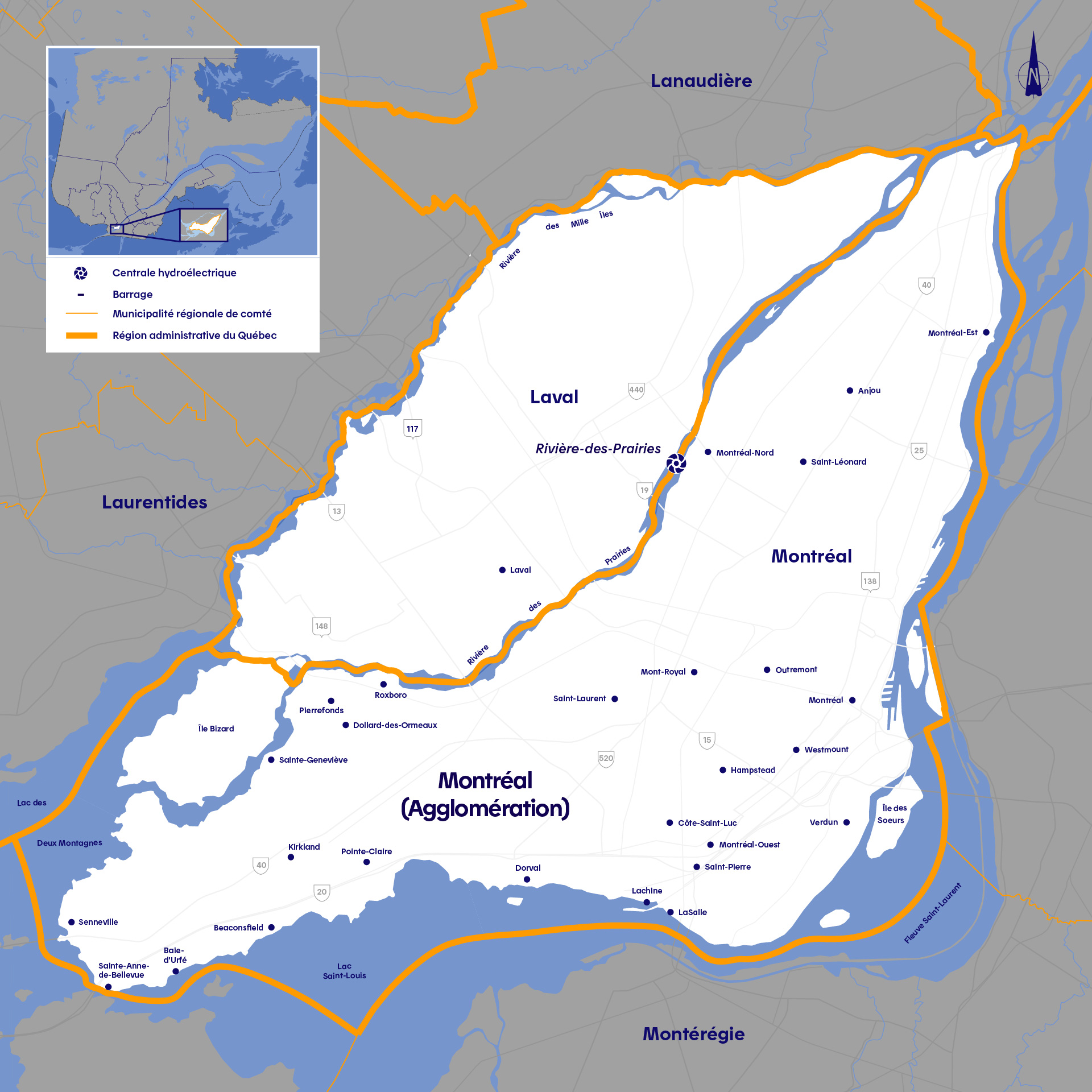
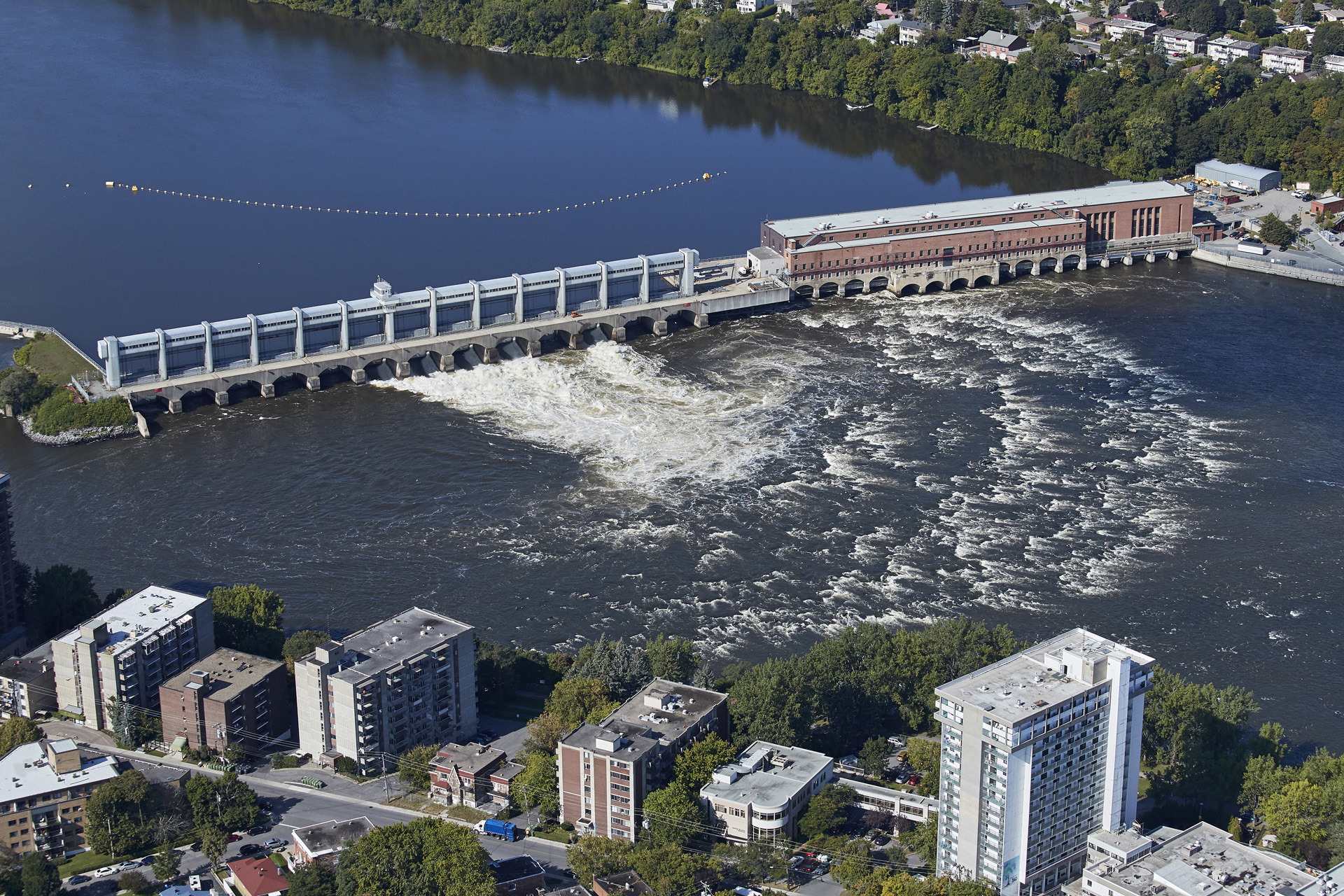
In the administrative regions of Montréal and Laval, Hydro‑Québec operates a single hydroelectric development: Rivière-des-Prairies generating station, on the river of the same name. The management of the flood is based on the facilities and watersheds located upstream of the island of Montréal and the Île Jésus (Rivière des Outaouais and Fleuve Saint‑Laurent).
Role of the Ottawa River Regulation Planning Board
The Rivière des Outaouais (Ottawa River) is 1,120 km in length, making it Québec’s longest river. It flows from Abitibi-Témiscamingue to Montréal. Hydro‑Québec is not the only operator of reservoirs and generating stations in this river’s watershed. Managing the water levels and flows in the Outaouais is a collaborative effort between partners. Every drop of water in the river is monitored by the Ottawa River Regulation Planning Board (ORRPB).
The ORRPB is made up of all the agencies that participate in managing the Outaouais watershed: the Ministère de l’Environnement, de la Lutte contre les changements climatiques, de la Faune et des Parcs du Québec, the Ministry of Natural Resources and Forestry of Ontario, Environment and Climate Change Canada, Public Services and Procurement Canada, the Canadian Coast Guard, Ontario Power Generation and Hydro‑Québec.
Visit the ORRPB website to track the hydraulic conditions of the Rivière des Outaouais.
A tool that identifies flows and water levels
We are installing measuring instruments on rivers and reservoirs where we operate dams and generating stations. They provide flow, water level and meteorological data. This data is available to you through a simple tool, which can provide information about flows on rivers and water levels in reservoirs.
Learn more about the Tool
We reduce spring flooding thanks to our reservoirs. Find out how.
From December to March, Hydro‑Québec gradually empties its reservoirs located in the northern Outaouais and Abitibi-Témiscamingue regions. When the spring thaw begins, they contain almost no water. From early April to early June, we hold back the water in our reservoirs as long as possible to limit inflows to the Outaouais and Saint-Laurent rivers, which are already swollen with water from the surrounding watersheds. However, the reservoirs can hold only 40% of the water inflows. The remaining 60% are from watercourses that do not run through our reservoirs; they flow freely and cannot be retained.
All the generating stations located on these watercourses are run-of-river and do not have reservoirs to hold water. The only facilities that impact the magnitude of the spring flood are the reservoirs located north of the watershed, which we manage in collaboration with our partners.
For more information on the Rivière des Outaouais watershed, visit the Ministère de l’Environnement et de la Lutte contre les changements climatiques (web page in French only).
Watch our expert explain how Hydro‑Québec contributes to managing the spring thaw along the Fleuve Saint-Laurent (St. Lawrence River).
Did you know?
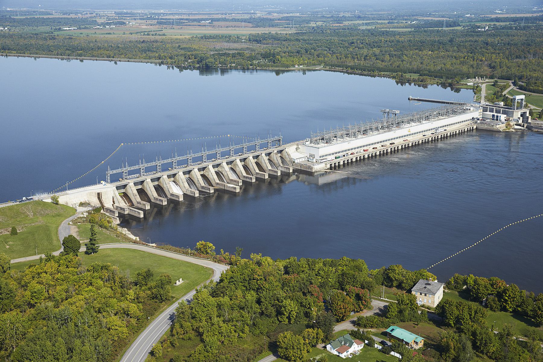
Carillon generating station, which is located at the foot of the Rivière des Outaouais watershed, is a run-of-river generating station.
It does not have a reservoir and therefore cannot store water from spring runoff. During flood periods, the spillway is opened to discharge the excess water.
If the spillway gates were closed at the peak of spring flooding, the water would spill over the facility within a few hours!
Hydro‑Québec does not manage the level of the Fleuve Saint-Laurent. The ILO‑SLRB does.
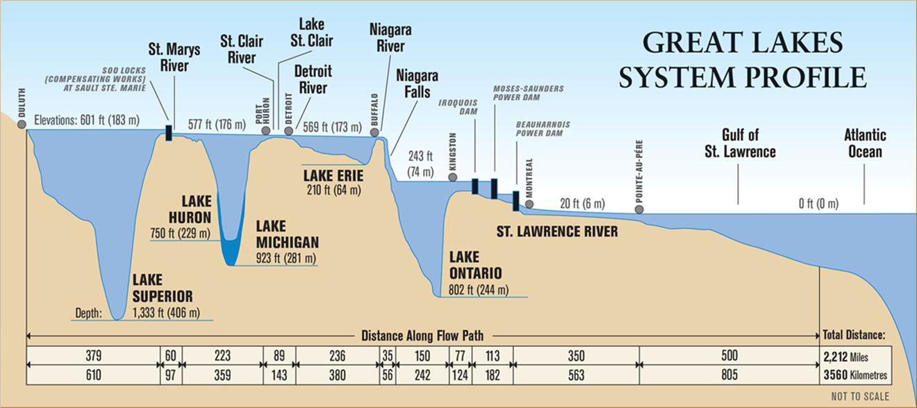
The inflows to the Fleuve Saint-Laurent (St. Lawrence River) are managed in conjunction with the International Lake Ontario – Saint Lawrence River Board (ILO-SLRB), which ensures that the regulation of the levels and flows in Lake Ontario and the Saint-Laurent complies with the legal requirements of the International Joint Commission (IJC). The mandate of the ILO-SLRB covers the entire watershed, from the Great Lakes to Lac Saint-Pierre and to the Montréal archipelago area.
The ILO-SLRB works daily with numerous stakeholders, including the St. Lawrence Seaway Management Corporation, the Canadian Coast Guard, U.S. and Ontario hydropower producers and Hydro‑Québec.
Hydro‑Québec has a direct role in managing the Beauharnois–Les Cèdres hydropower complex, located in the west of the Montérégie region. We work with the ILO-SLRB to safely manage the ice near the complex facilities. The complex is made up of only run-of-river generating stations and therefore cannot retain water. For example, Beauharnois generating station receives the water that comes through the Beauharnois canal, runs it through turbines and then redirects it toward Lac Saint-Louis. It should be noted that Hydro‑Québec does not manage the level of the river.
During the spring thaw, the members of the ORRPB and the ILO-SLRB work together to reduce the inflows to the Montréal archipelago area. Since Hydro‑Québec operates the two generating stations closest to the archipelago, our experts play a key role in this aspect of flood management every spring.
Frequently asked questions
What are the facilities owned by Hydro‑Québec in the Montréal and Laval regions?
Why can’t Hydro‑Québec hold back more water at the generating stations on the Outaouais and Rivière‑des‑Prairies rivers?
What is the purpose of the water level variations in the Outaouais and Rivière‑des‑Prairies rivers?
Why has the flow in the Saint‑Laurent been higher since 2017?
How are citizens informed of the progress of the flood on the Outaouais and Rivière‑des‑Prairies rivers?
Questions on how Hydro‑Québec facilities are managed? Write to us at Affairesregionales@hydroquebec.com.
