How Hydro-Québec installations reduce the impact of spring runoff
Each year, our experts work actively to make the best use of our network of facilities in order to limit the impact of spring runoff on populations.
We are putting our expertise to work to anticipate and limit spring flooding
Throughout the year and especially in the spring, we work in tandem with all stakeholders concerned. It’s part of our mission.
The reservoirs always reduce the extent of the spring runoff
We empty reservoirs in winter so that they can store very large amounts of water in the spring. If these facilities were not there, the water level during the spring runoff would be even higher.
Run-of-river generating stations have no impact on the magnitude of spring runoff
Since they have no reservoirs, they have no way of retaining water. In times of spring runoff, you just have to open the gates to let the river run free.
Frequently asked questions
How do Hydro-Québec facilities affect the magnitude of spring flooding?
Hydro-Québec’s facilities can actually limit the magnitude of spring flooding. The company has two types of facilities – some have large reservoirs and others are run-of-river facilities.
Those with large reservoirs can retain significant amounts of water in the spring, and they are emptied during the winter months, when the water is used to supply hydropower generating stations to meet the population’s high demand for electricity. Hydro-Québec ensures that most of its reservoirs are practically empty in the spring. This way, the reservoirs can retain a large amount of water resulting from snowmelt and rainfall, which would otherwise flow directly into rivers. Hydro-Québec’s reservoirs thus help to reduce the impact of spring runoff.
What are run-of-river generating stations, and why do they not have a significant impact on spring flooding?
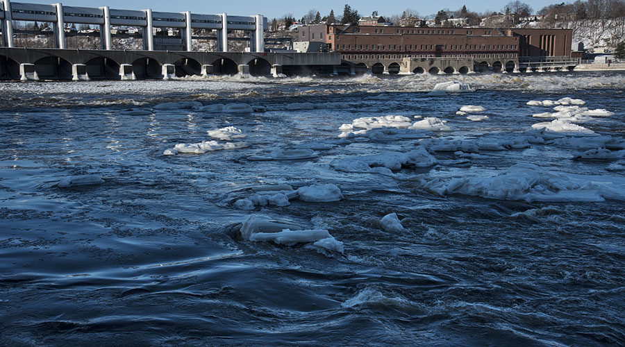
Run-of-river stations do not have reservoirs and thus cannot retain spring floodwaters. In these facilities, water is simply left to run through the turbines to generate electricity. When water inflows become too large, the spillway gates are open for water to run through. Even if we tried to use such generating stations to retain the excess water, doing so would not reduce the magnitude of the flooding at all because the water would overflow in at most a few hours and would only damage the station.
Why is the water level upstream of a run-of-river generating station so low during the spring thaw?
The water level is low because, a few days before the spring flood period starts, we lower the water level in order to reduce the effect of the facilities on the river flow and the effects of high flow backing up in the river. You could say that we try to make the river behave as it would in its natural state, that is, before the generating station was built.
The water level upstream of the generating station can go down over a distance of several kilometres, depending on the river’s natural topography.
The river flow is then naturally determined by restrictions such as islands, narrows, shoals or rapids, not by the hydropower facilities. These natural restrictions are what cause water levels to rise further upstream. The stronger the river flow, the greater the backup will be.
When water levels are lowered, the effect downstream of facilities is negligible. To reduce water levels upstream, we temporary increase the flow through the turbines for a few hours or a few days, before the water inflows increase. Once the upstream level has stabilized, a run-of-river generating station lets the river’s natural flow pass through, no more, no less. The return to normal operating levels takes place when the spring runoff subsides.
Why does amount of snow and precipitation up north affect the magnitude of spring flooding in regions further south?
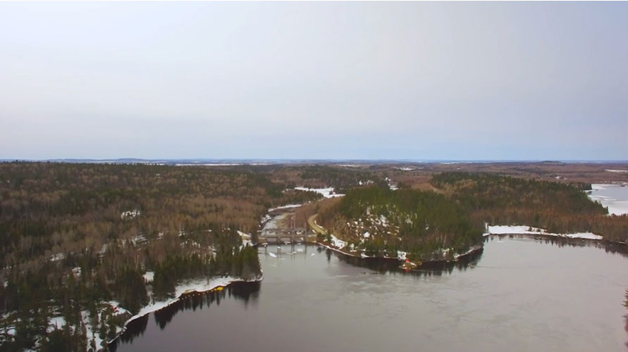
The level of a river is affected by its whole watershed, that is, the entire territory that feeds it. When two rivers meet, their watersheds combine, resulting in a huge network of watersheds and sub-watersheds that end up flowing into large rivers such as the Rivière Outaouais (Ottawa River), the Saint-Maurice and, ultimately, the Saint-Laurent. It can take a few hours to a few weeks for water to travel from the highest point, upstream, to the lowest point, downstream, depending on the nature or characteristics of the terrain and the size of the watershed.
Do Hydro-Québec employees only manage water flows during the spring runoff period?
No. Hydro-Québec employees monitor waterways and precipitation daily, throughout the year.
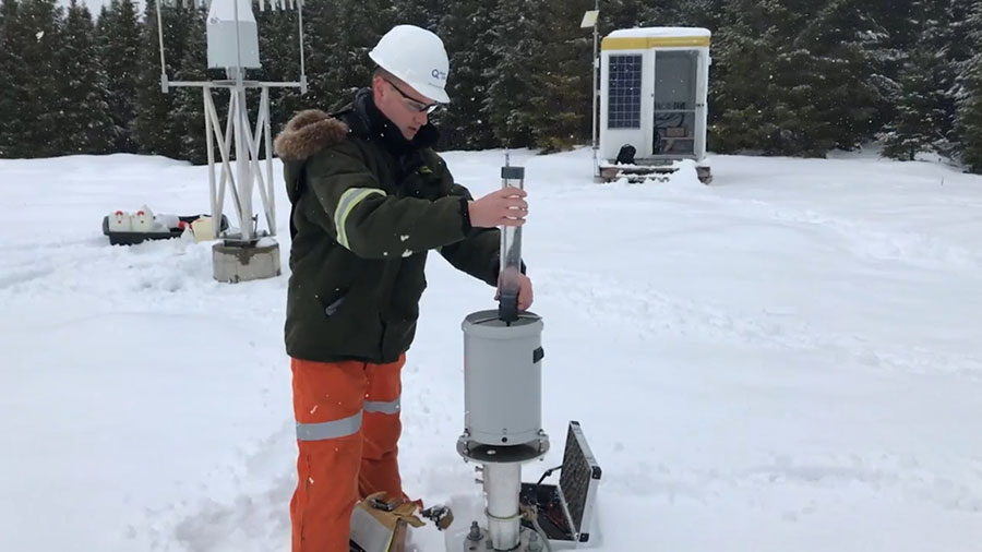
A network of hydrometeorological stations make it possible to constantly monitor river levels and flows as well as rainfall and snowpack.
In winter, employees also analyze the snow cover to determine its density and water content and thus better predict how much water will flow when it melts.
Is Hydro-Québec alone in managing flows on the rivers where it has facilities?
For most watersheds, and in particular for the Rivière Outaouais and Saint-Laurent watersheds, water is managed through the concerted effort of all organizations involved in water management in Québec, such as the Ministère de l’Environnement et de la Lutte contre les changements climatiques, the Ottawa River Regulation Planning Board and the International Lake Ontario–St. Lawrence River Board. All generating facility operators are also involved, including Hydro-Québec.
Where can we find information on Québec river water level and flow rates recorded during spring flooding?
The Ministère de l’Environnement et de la Lutte contre les changements climatiques provides information on Québec river water level and flow rates on its website.
Other relevant websites:
During the spring runoff period, is Hydro-Québec responsible for informing the public about flooding risks and what to do in the event of a flood?
No. The Ministère de la Sécurité publique is responsible for managing all communications during floods. It works in concert with municipalities, which act as the intermediary with residents.
During the spring melt, Hydro-Québec’s responsibility involves managing its facilities to lower river levels as much as possible and communicating any relevant information to the Ministère de la Sécurité publique and affected municipalities.
Did you know?
- At Hydro-Québec, preparations for the spring thaw last several months, and we rely on meteorologists, engineers, hydrologists and even oceanographers to monitor rivers and lakes.
- Each spring, the reservoirs in southern Québec are brought to their lowest levels so they can retain as much water as possible from the snowmelt.
- In some regions, the amount of water retained represents up to 40% of all the water found on the territory.
- Gouin Reservoir, located in Haute-Mauricie, is nicknamed the “Guardian of the Saint-Maurice River,” and its construction was completed in 1917. Want to know more? Visit the Gouin Reservoir web page.
- The Rivière Saint-Maurice watershed extends over 42,651 km2, an area larger than the Netherlands.
- The Rivière Outaouais watershed is three times larger than the area of Switzerland. A drop of water can take up to three weeks to flow from its source down to the Montréal region.
- There are thirteen main reservoirs in the Rivière Outaouais watershed, and Hydro-Québec owns only four of them. La The Ottawa River Regulation Planning Board is responsible for the integrated management of all partner reservoirs.
- Hydro-Québec has invented and marketed a device, the GMON, to determine the amount of water contained in the snow cover on a daily basis. Find out more about the GMON device [video in French only].
- Many hydropower generating stations cannot retain water in the spring. They are called run-of-river generating stations, and the majority of facilities located in southern Québec are of this type.