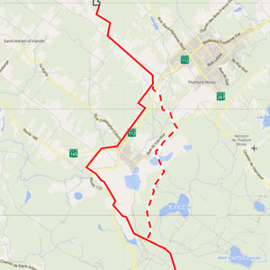
The line route selected is 100.9 km long and crosses both the Appalaches MRC (37.3 km) and Du Granit MRC (63.5 km), affecting eleven municipalities in all.
The future line will be paired with one or more existing lines along 73% of its route.
The crossing point, where the line will connect to the power system on the U.S. side, is located on private land northeast of ZEC Louise Gosford in the municipality of Frontenac.
Line route modified at Thetford Mines and Saint‑Joseph‑de‑Coleraine
Following a public consultation in spring 2020 and the BAPE hearing held the following summer, Hydro‑Québec modified the line route in the area of Thetford Mines and Saint‑Joseph‑de‑Coleraine.
The route variant submitted for consultation was adjusted and improved to respond as fully as possible to the concerns expressed by the communities, while taking into account the technical issues associated with the area to be crossed.
The line will therefore cross the old British Canadian mine and will meet up with Hydro‑Québec’s initial route at Lac Noir.
The route initially proposed ran along the right of way of an existing power line. The modification will move the new interconnection line farther away from the Black Lake residential sector in Thetford Mines, and will reduce the impacts on property owners in the mine area.
In Saint Joseph de Coleraine, the route was shifted west, close to the mining road.
Environmental approach
Our decision to select this route was made based on an environmental approach involving the following steps:
- Describe the environment.
- Analyze the technical and environmental constraints as well as the sensitive elements.
- Develop a route.
- Assess the impacts.
- Identify appropriate mitigation measures.
- Agree on the follow‑ups to be conducted once the new line has been commissioned.
These steps, which were carried out in collaboration with the host community helped us to develop a solution and then adjust and refine it based on specific regional realities
Project optimization
As a result of numerous exchanges with host communities, the following modifications have been made to the project so far:
- The route of the approximately 24‑km segment of the new line in the Du Granit MRC has been relocated to protect woodlands or follow lot boundaries.
- To the extent possible, the future tower sites have been determined in accordance with landowners’ requests, to avoid valued elements on their properties.
- The line route has been adjusted to ensure the safe coexistence of the power line and the region’s extensive logging operations.
- The commitment has been made to plant shrub species that are compatible with the future power line to limit the impact of land clearing operations on certain properties.
- The project schedule has been adjusted to take the sugar bush season into account
![]() (in French only) with the Ministère de l’Environnement et de la Lutte contre les changements climatiques. The study presents the line route selected by Hydro‑Québec for the project.
(in French only) with the Ministère de l’Environnement et de la Lutte contre les changements climatiques. The study presents the line route selected by Hydro‑Québec for the project.
 Planned tower
 Line route selected
 Tower for the line route variant
 Appalaches substation
 Crossing point
![]() du Ministère de l’Environnement et de la Lutte contre les changements climatiques. (in French only)
du Ministère de l’Environnement et de la Lutte contre les changements climatiques. (in French only)

